This business track is associated with the promotion, development, and implementation of Enterprise Geographic Information System at the heart of the digital utility. The business activities are related to the provision of utility expertise, business modeling, applications deployment, and assuring the synchronization of the geo-spatial platform with the physical development of the network.
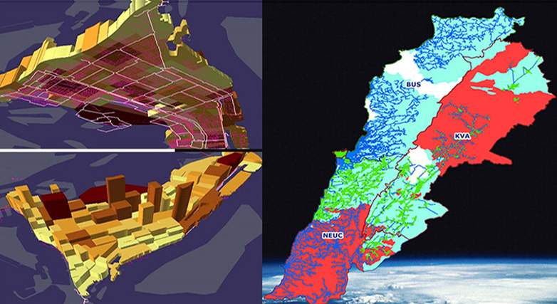
NEEDS, over the past years, has executed an aggressive business development plan along with regional consulting firms for the promotion of Utility GIS to a number of Electric and Water Authorities to provide a paradigm-shift in the utility planning, operation, and service activities. This plan resulted in adopting large scale Enterprise GIS Projects in Lebanon, Abu Dhabi, and other Gulf Countries.
NEEDS, over the past years, has executed an aggressive business development plan along with regional consulting firms for the promotion of Utility GIS to a number of Electric and Water Authorities to provide a paradigm-shift in the utility planning, operation, and service activities. This plan resulted in adopting large scale Enterprise GIS Projects in Lebanon, Abu Dhabi, and other Gulf Countries.
NEEDS Chairman with a highly specialized team have managed the process of building the geo-spatial platform for the transmission and distribution systems in a fast track mode at the Abu Dhabi Water and Electricity Authority. The team was able to position GIS in the core of most of business processes, which resulted in the growth of the GIS community from 300 users to 1000 Users. As a result, the developed GIS platform is well recognized regionally and internationally.